

The Bracebridge Resource Management Center Trails or BRMC trails are located off Highway 11 just north of Bracebridge. There is a mix of double and single rack, making these trails perfect for all skill levels, with lots of great signage and two parking lots for you to access the trails.
RIDE GUIDE FOR GREEN SINGLE-TRACK TRAILS
RIDE GUIDE FOR BLUE SINGLE-TRACK TRAILS
Click here for the 2026 Printable Trail Map
Please note:
- Washrooms are shown on the map. Please note, these are outhouse style toilets that are maintained. Please respect the outhouses and advise us immediately if there is maintenance required on these.
- Pavilion/Picnic areas are also shown on the map below for mid-riding snacks and lunch.
- There are NO water fill stations within the BRMC, so make sure to bring enough water for your entire ride! Please “Pack in Pack Out” and use the animal proof garbage containers supplied within the trail systems. Please do not leave bags of garbage next to the bins, as this will only attract unwanted animals.
- As this is a volunteer based club, please let us know via Facebook/Instagram/Email (info@morca.ca) OR submit a report on Trailforks if there are any trails requiring immediate maintenance, trees down, etc.
- No motorized vehicles are permitted on the BRMC singletrack trails.
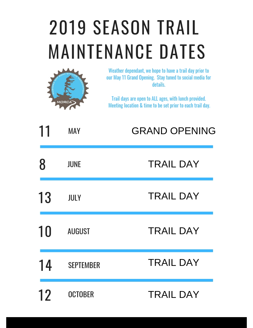
- Trail Build/Maintenance days are scheduled for each month in the summer season.
- Trails are approximately 10 minutes from downtown Bracebridge, with many options for lunch, coffee, local brews. Visit our sponsor page to see who has supported MORCA this season.
- FAT BIKE SEASON – Please note, that these trails are shared as multi use trails. Please DO NOT cross XC Ski tracks where possible. If required, please cross at a 90 degree angle to avoid any spur lines from the groomed trails. You will be sharing these trails with hikers, xc skiers, snowshoers etc. Please be mindful of all user groups and their enjoyment on the trails.
Winter Fat Biking & Snowshoe Map for 2026 Trail Map